Regional studies & surveys
Although the Swiss School has been mainly investigating the ancient city of Eretria and its main sanctuary of Amarynthos outside the city walls, several scholars have recently carried out exploration surveys in other Euboean sites as well as in Attica.
Eretria-Amarynthos Survey Project (EASP 2021-2025)
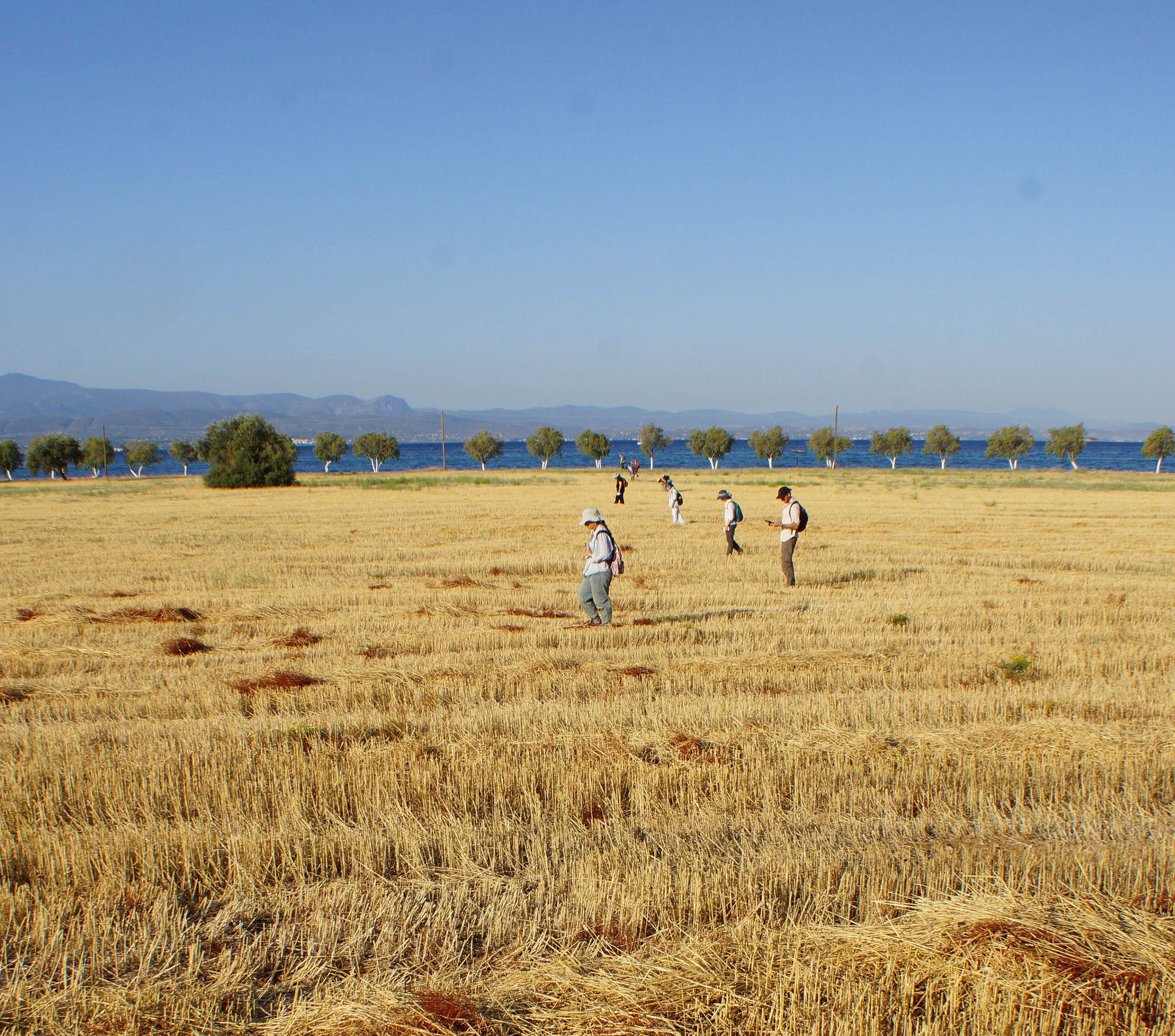
The ongoing research project “Amarynthos and the Making of the Eretrian Sacred Landscape” includes a multidisciplinary regional survey project whose goal is to study the integration of the Artemision within the ancient landscape. The first axis of the project mainly deals with the region’s archaeology, human ecology, and history from the Bronze Age to the Byzantine period, while the second tackles issues that are more specific to the sanctuary of Artemis, such as the relations between the shrine and the demes, the trace of the sacred way (hiera odos), and the topography of the religious landscape.
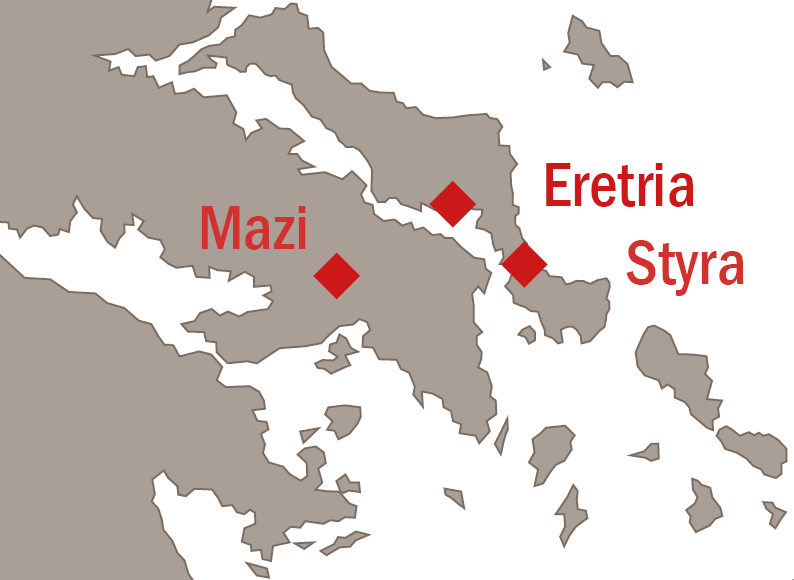
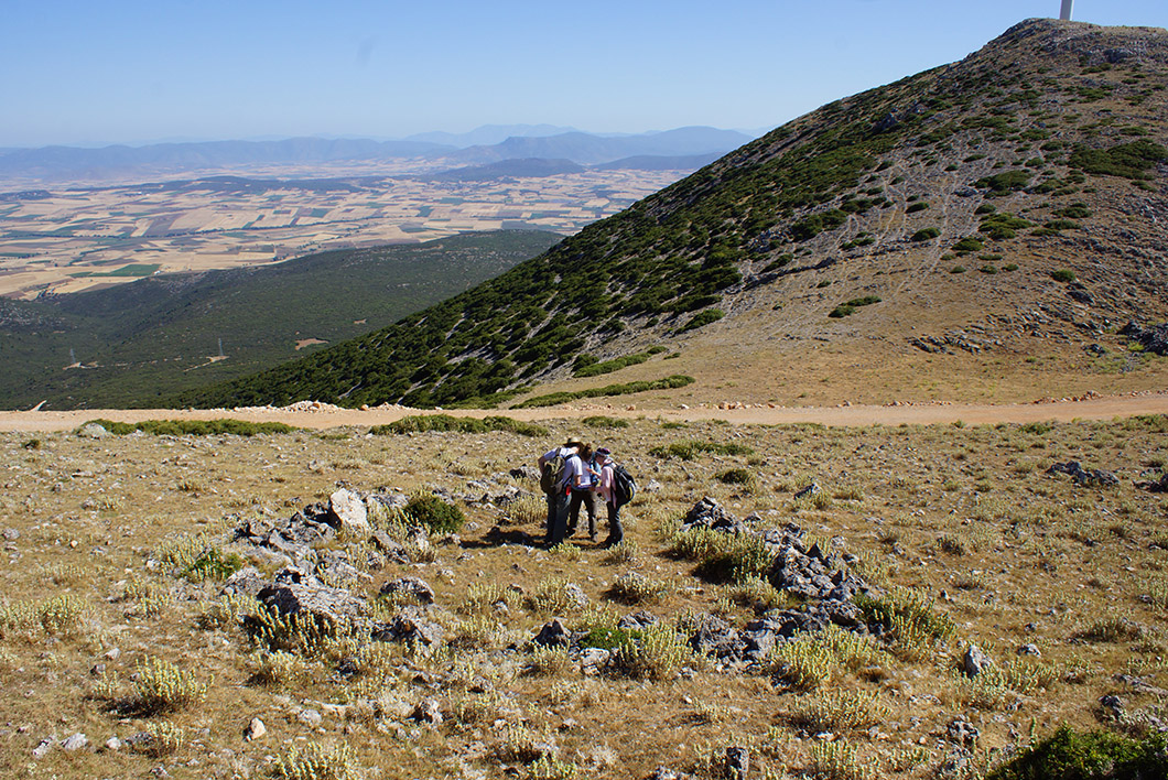
The “dragon houses” of Euboea (2020-2022)
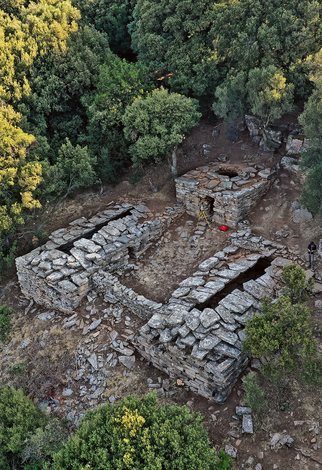
Α number of enigmatic dry stone buildings, located on the slopes of the mountains of southern Euboea, stand out due to the monumental size of their building blocks. Their cyclopean construction as well as their corbelled roof system made the inhabitants of the area believe that they were built by „dragons“, anthropomorphic giants with supernatural powers. This explains the name of drakospita or “dragon houses”, by which they are known to the present day. To date, eight such complexes have been found in the area of Styra, which, despite having attracted the interest of archaeologists, have not yet revealed all their secrets. In the absence of ancient parallels, the issues related to their dating and function(s) remains highly debated.
The ongoing project on the drakospita of Southern Euboea focuses on reviewing previous research and on collecting new archaeological evidence based on exploratory trenches and architectural survey, aiming to improve our understanding of these buildings and to promote the development of these archaeological sites. The project is a collaboration between the Swiss School of Archaeology in Greece (ESAG) and the Ephorate of Antiquities of Eubeoa (EAE), under the direction of Karl Reber (ESAG) and Aggeliki Simosi (EAE).
Mazi Archaeological Project - MAP (2014–2017)
The Mazi Archaeological Project (MAP) is a diachronic regional survey in northwest Attica, Greece. The Mazi Plain is a small valley situated between the Kithairon and Pateras mountain ranges and is a key location in the borderlands between Attica and Boeotia. Strategically positioned on the main route between Eleusis and Thebes, the plain also constitutes a critical crossroads on regional and interregional land routes. Today, the route continues to be important as the Old National Road runs through the plain, where the modern town of Mazi (formerly called Oinoe) is located. Through fieldwork in the summers of 2014–2017, MAP has aimed to address long-term questions of human occupation, human-environmental interaction, territoriality, regionality, and movement in periods ranging from prehistory to the present. After the 2017 study season the team has now moved to the publication phase of the project.
Team & direction
MAP project is a collaboration between the Ephorate of Antiquities of West Attika, Pireus, and Islands and the Swiss School of Archaeology in Greece, directed by Sylvian Fachard (Director of the Swiss School), Alex Knodell (Carleton College), and Popi Papangeli (Ephorate of west Attica, Piraeus and Islands).
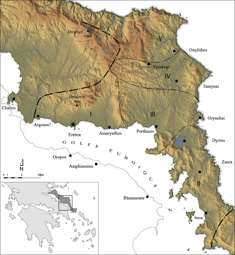
The territory of Eretria (2004–2012)
For many years Swiss archaeologists were primarily focused on the intra-muros settlement of Eretria. More recently, a growing interest in the wider setting of the ancient city has yielded significant results. The polis of Eretria extended far beyond its fortification walls. Its territory, the “Eretriad”, covered at the end of the 4th c. BC some 1300km2 and was among the largest in continental Greece during Classical Antiquity. The civic organization of this territory and the exploitation of its resources have been the subject of in-depth historical and archaeological studies. The territory comprised hundreds of demes, farms, fortified sites and places of worship.
Further reading
Denis KNOEPFLER, Les territoire d’Erétrie et l’organisation politique de la cité (dêmoi, chôroi, phylai). In M. H. Hansen (ed.), The Polis as an Urban Centre and the Political Community. Symposium August, 29–31 1996, Acts of the Copenhagen Polis Centre vol. 4. Copenhagen 1997, 352–449.
Sylvian FACHARD, La défense du territoire. Étude de la chôra érétrienne et de ses fortifications. ERETRIA XXI, Fouilles et recherches. Gollion 2012.